This is how you use Google Maps on your Fitbit wearable
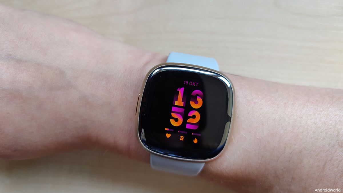
Google Maps has recently become available on your Fitbit wearable, if you wear a Versa 4 or a Sense 2. Here’s how Google Maps works on those devices and how you can enable it yourself.
Contents
Maps on Fitbit
Before we dive into the functionality, it’s good to realize that Maps on Fitbit is limited. You can only use it for driving, cycling and walking (so not for public transport) and you cannot start navigation from your Fitbit. You still need your phone for that, which sends the information to the Fitbit, which then displays in text where you need to go. Not in map form. That said, Google Maps is a really useful addition to Fitbit wearables.
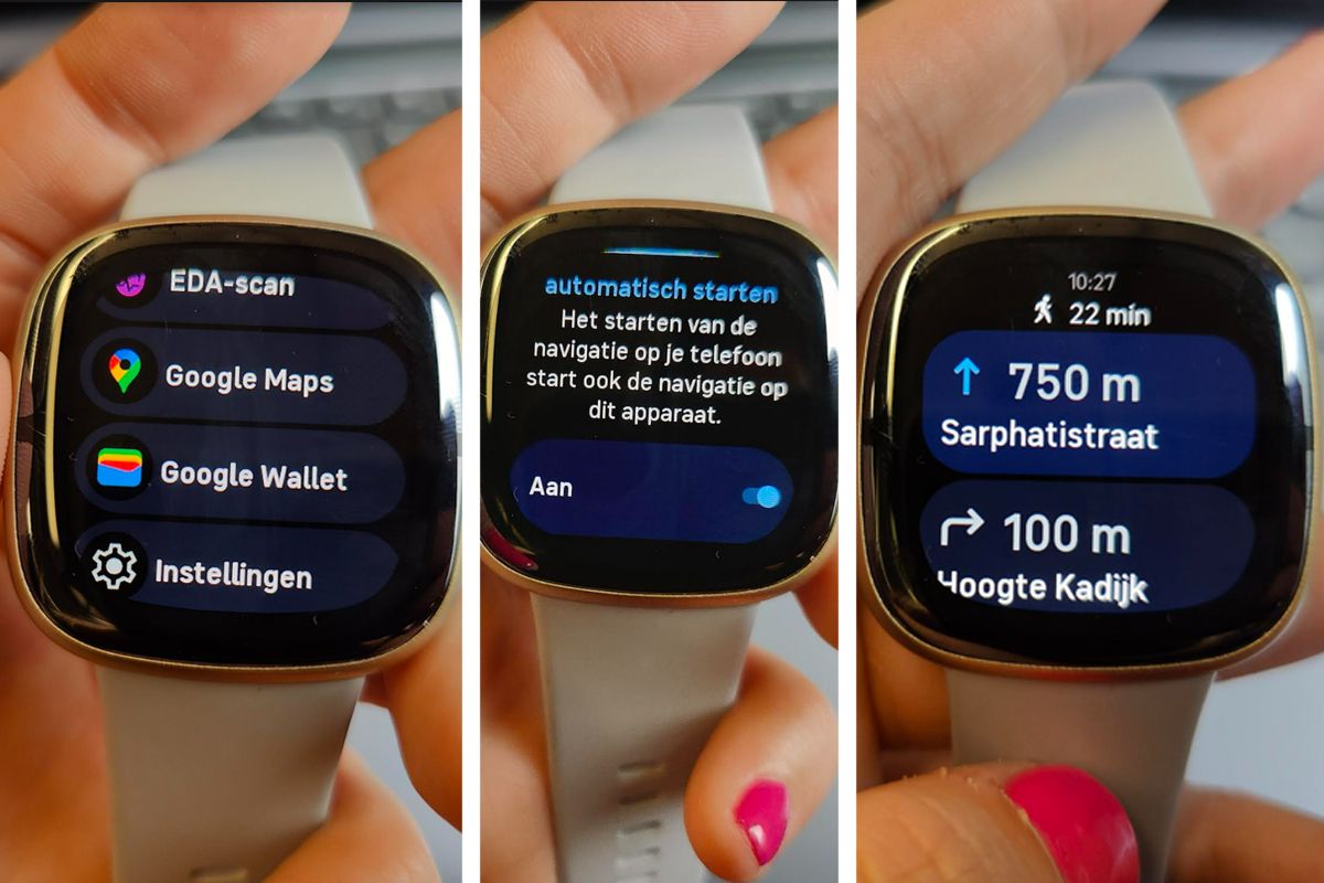
Because of this you don’t have to look at your phone like an über tourist every time you walk somewhere. You occasionally glance at your smartwatch and you know enough. However, you must first prepare the Fitbit for Maps. You do this by going to your profile picture in the Fitbit app on your smartphone at the top right, then selecting your Versa 4 or Sense 2. You would think that you would have to go to the Gallery, but that is not the case. Maps is already displayed as a large tile. Tap it and you can install the app on your Fitbit.
Once it’s on your Fitbit, it’s best to enable it to sync automatically. You do this on the Fitbit itself, by pressing the button on the side to open the apps and then checking the box. You will notice that when you open Google Maps on your phone, you see on your Fitbit that it connects and then shows that a route is in progress. You can then continue tapping and you will see exactly which streets you need to get to your final destination.
You can also turn it off by following the on-screen instruction. That is all self-evident. In any case, it is commendable how large the information is visible on the mini screen on your wrist: you can see very clearly which street you need, and for the further settings you have slightly smaller print, but that is not a problem because you use it whether walking or cycling anyway.
Not always suitable
We do find the route instructions slightly less suitable for people who are driving. We would have preferred Google Maps to be available on Fitbit for public transport. That you can check your wrist to see if you need to get off at the next stop, for example. In the car you don’t quickly look at your wrist to see the route, certainly not because you will benefit more from a complete map anyway.
We are also very pleased with Maps on the wearable. It makes your Fitbit a lot more convenient this way. Especially if, for example, you ride a bicycle and are not allowed to hold your smartphone in your hands. Or, if you are abroad, riding an electric scooter that is not so easy to drive without a hand (and it is also very unsafe to do so). In short, many advantages to this integration of Google Maps on Fitbit.
Buy Fitbit Sense 2
Fitbit Sense 2 is the most advanced health and fitness smartwatch with new continuous EDA sensor for stress detection. The Fitbit Sense 2 puts health and fitness at the center of attention. With a thinner and lighter design, the watch is even more comfortable on your wrist. The physical button is also back, in a new, higher location for easy access during your workout. With more than six days of battery life and fast charging, the Sense 2 is sure to keep up with your busy lifestyle.
299.95 euros
Shop at:
Related articles
Have you already used it? Leave your findings in the comments to this article.