Google Maps: these sensitive or unusual places that are hidden from us
American society Google is not unanimous when it comes to talking about the protection of personal data. However, it is clear that some of the products it offers are quite fabulous. Google maps is part of. The online program also available in application on the phone is none other thana cartography of the whole world seen from the sky. It was launched in February 2005 on the North American continent before expanding the following year to certain European countries, including France. The technical prowess is such that we can zoom to home height with highly defensible image quality. Pushing the technique even further, the service integrates functionality a few years later Google Street View which allows you to walking the streets of most cities as if you were walking there. The precision of the images is even more incredible and you can practically go sightseeing without taking your eyes off your screen.
The freedom of discovery nevertheless knows a few areas that are for it. forbidden.
Blur of you
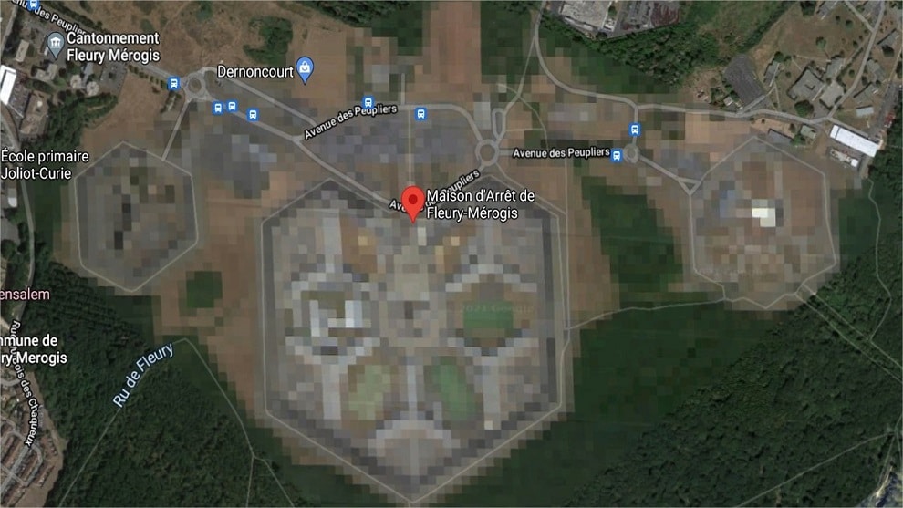
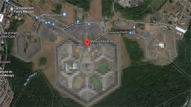
Governments have indeed the possibility of asking Google not to display aerial photos of certain places in their territory, starting with France. The areas are then blurred and it is impossible to see the details. This is the case, for example, in France, for all that is, among others, military bases, prisons, uranium ore processing plants or nuclear power plants. The Fleury-Mérogis detention center is one of the blurts, as is the Cattenom Nuclear Power Generation Center, which is none other than the ninth largest nuclear power plant in the world.
You will find this rasterization on all such buildings around the world. Even Area 51 in Nevada, the supposed US base where aliens are dissected, is nothing but a big white puddle while everything about the White House is dated and approved by Homeland Security. It is indeed understandable that a question of national security could justify these decisions not to show these buildings on the map.
Other places are entitled to this attention for reasons that are sometimes much more obscure.
Pixel (c-) art (-e)
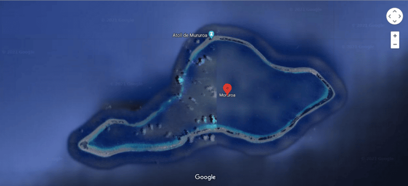
North Korea offers, unsurprisingly, very few cities and roads, and most of the territory is not accessible on Maps. It must be said that the South Koreans have refused to provide their map data to Google for fear of a further escalation of violence. In line with their privacy policy, you will also find many houses blurred on German maps, the owners having the right to ask Google not to show their homes on Street View. The island of Mururoa, infamous for having been the site of 138 French nuclear tests between the 60s and 90s, is half blurry, which does not bode well for its current state.

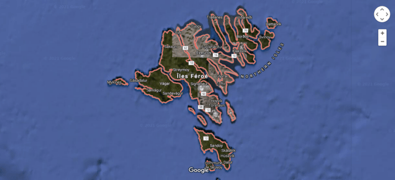
Sandy Island, covered with black pixels, is a “phantom island” which in fact never existed and which was “de-discovered” in 1979. What exactly gives it an interest for those who want to give birth to a conspiracy. This is exactly the same for the Faroe Islands, Danish territory which we cannot distinguish much.

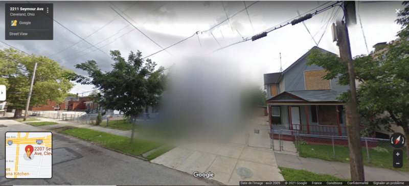
Much more creepy, Google Street View decided to blur 2207 Seymour Avenue in Cleveland, another infamous place where a man held three women captive for 10 years. Even if the house where the crime took place has since been destroyed, the news is still entitled to censorship.

In the same style, but totally unjustified, two houses on Princeport Road in the English quarter of Stockton-on-Tees are blurred in Google Street View. Tenants have absolutely no idea why or how.
And you, do you know any other unusual invisible places?


