Apple Maps gets huge update for Germany
Apple has presented an extensive Germany update for its maps app. The focus is on a much more precise display and navigation, which should help pedestrians, cyclists, public transport users and drivers alike. Apple has also taken care of an extended 3D view of some buildings.
Apple Maps: Major update for Germany
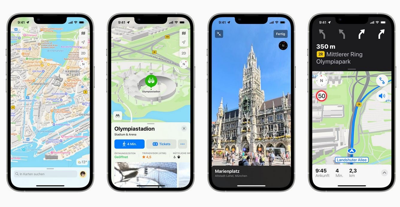
Months after the USA and other countries, Apple has now significantly refreshed its map app for Germany. When competing with Google Maps is now more detailed maps in 2D and 3D to disposal. Zones are now also more clearly separated from each other, for example to be able to distinguish residential areas from green areas at a glance. Indoor maps are now available for some airports and shopping malls.
For motorists, Apple shows the applicable speed limits, which should remain exact even in the event of short-term changes (roadworks). When navigating, regardless of the mode of transport, users receive more natural Siri prompts such as “left at the traffic light” instead of “left in 200 meters”. Siri can also share ETA with friends. The estimated time of arrival updates automatically if there are any changes.
Another innovation in navigation concerns the change of transport mode. If users first take the bus and then continue on foot, the app changes the navigation itself. Users can also alert Siri to problems on the route, such as an accident or an obstacle on the road. This is to warn other users who are also on the route.
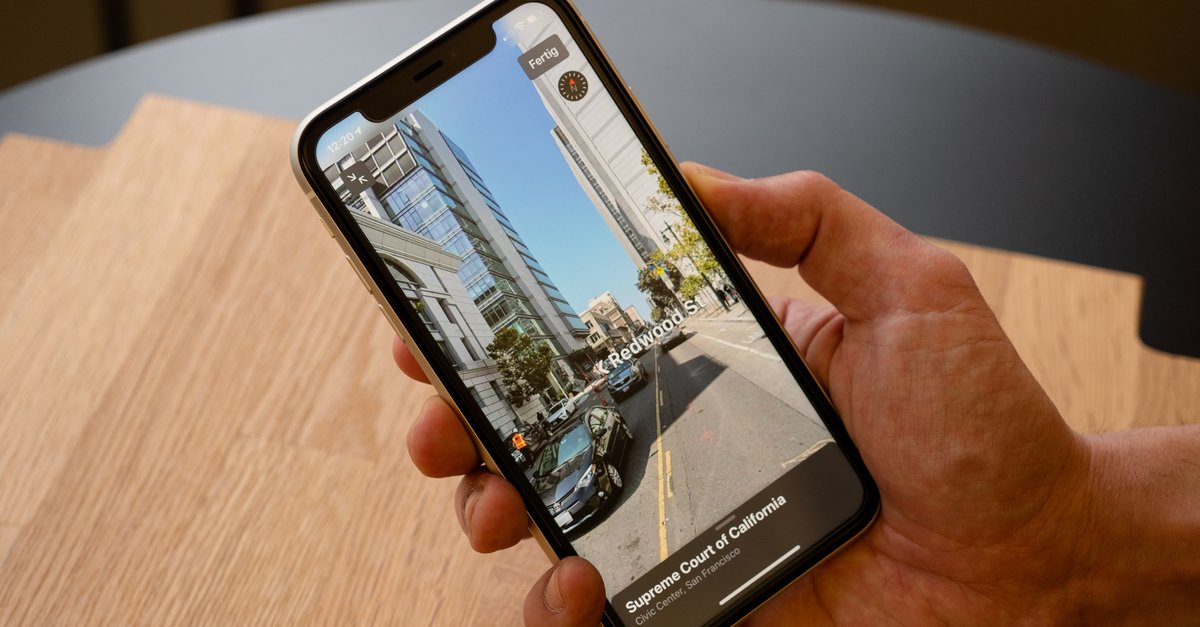
With “Look Around” or “Look Around” is now also available Apple’s counterpart to Google’s Street View ready. Initially, however, the function will only be available in Munich, with other cities to follow (source: Apple).
If you decide to stay with Google Maps, we have a few tips for you:
Apple maps with lots of public transport information
The app shows the bus and train Local traffic information in real time with timetables and departure and arrival times. Apple Maps also shows where the train or bus is on the route. In the event of a failure, the app reports.
![Das kann der Rucksack von Db [Anzeige]](https://www.basicthinking.de/blog/wp-content/uploads/2023/09/ramverk-jpg.png)