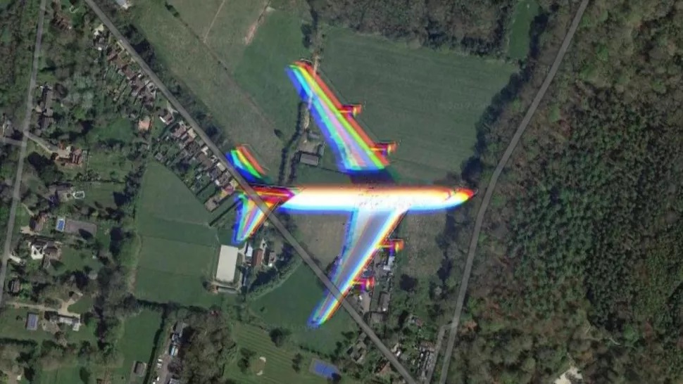
An invisible bomber did not escape Google Maps
On duty Google Maps you can find a number of unusual photographed objects. From special pentagrams in Kazakhstan to parked UFOs in Romania. One user Income according to the portal recently TechRadar noticed in satellite images of Google Maps flying invisible bomber.
The invisible bomber has already appeared on Google Maps, but not during the flight
Although the flying B-2 Spirit bomber can fly at speeds of up to 1,010 km / h, it was captured on Google Maps while flying over a remote part of Missouri. Of course, his image is slightly blurred and also has some red, green and blue elements. Unlike conventional cameras, satellites measure the intensity of certain wavelengths of light (red, green, and blue) in multiple images, which are then combined to form a single image.
Google Maps collects imagery from a variety of sources, specifically attributed to satellite imagery from Maxar Technologies. An image of the bomber was found by a Google Maps redditor Hippowned. This is not the first time an invisible bomber has been spotted in them. However, he had previously been seen parked on the runway of Whiteman Air Force Base, which is currently home to the B-2 Spirit.
Images of flying objects can also look like anomalies on Google Maps
However, seeing fast-moving objects such as airplanes and especially invisible bombers in satellite images is relatively rare. For example, in 2017, users of the Reddit social network discovered a transport aircraft during a flight over South Downs National Park in the United Kingdom. It also showed the same red, green and blue artifacts as in the B-2 Spirit.

The method Google uses to compile its satellite imagery may create other anomalies for aircraft. In 2019, a Google Earth user noticed what looked like a shadow of an airplane under the sea in images of the Edinburgh coast of Scotland. However, according to a Google spokesman, the plane only appears to be underwater, because each satellite image in Google Maps is actually a compilation of several images.
Our tip
Win a Nokia X10 Smartphone | NAY Android Roka 2021


